News & Articles
Browse all content by date.
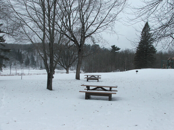
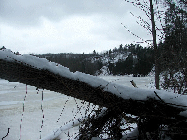
Chambers Grove, a park on the St. Louis River at the far western end of Duluth, has had a lot of work done to it in recent years. The biggest changes have been made to the shoreline. For decades, the shoreline was armored with steel sheet piling, an arrangement that essentially cut people off from the river. Though you could walk along the boardwalk right next to the river, the water was a four-foot drop away, on the other side of a chain. You could look out over the water or cast a fishing line into it, but you couldn’t touch it.
In 2015, the Department of Natural Resources, the Army Corps of Engineers and other agencies teamed up to reconfigure the shoreline at Chambers Grove. The sheet piling was removed and the land was graded in a gentle slope down to the water. Entire tree trunks with roots attached, known as “toe wood,” were then stuck horizontally into the shoreline like pencils, so that only the roots were left exposed at water’s edge. This stabilized the shore and provided good places for small fish and other creatures to hide from predators. Stone jetties built into the water redirected the main flow of the river to the middle of the channel and established slower-moving “riffle” habitat (preferred by sturgeon for spawning) closer to shore.
In the two years or so since the project was completed, grasses and shrubs have begun to establish themselves at water’s edge, creating a much more natural connection with the river than existed before. Would you like to dip your toe in the water? Launch a canoe? Now you can.
The softened shoreline also serves a valuable hydrological function by reducing the destructiveness of floods. During floods, shorelines protected by sheet piling resist the rising water, then get destroyed by it. When the shoreline slopes gently up from the river, however, the floodwaters simply rise up the slope, widening the river and losing their destructive energy.
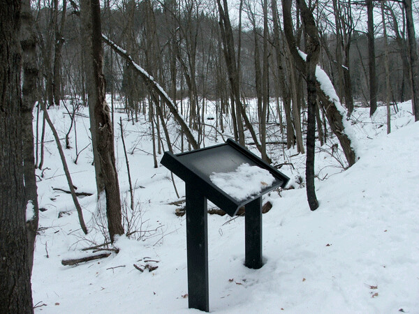
In conjunction with the shoreline restoration work, the city has made improvements to park amenities. The entry road and parking lot have been improved, and additional parking spaces added. A new playground and new ADA-accessible restrooms have been built. An ADA-accessible path has been built to the picnic pavilion. A half-mile-long interpretive loop trail has been built in the woods at the west end of the park. Stands for eight interpretive signs have been installed along the trail, minus the actual signs. Informational panels will be fabricated over the winter and attached in the spring.
Constructed by Duluth landscape architecture firm SAS at a cost of $26,750 (paid for with a state grant), the interpretive trail loop passes through areas of low-lying forest and along the bank of the St. Louis River. Being ADA-accessible, it is substantial: The tread has been built up with gravel, culverts installed, at least three bridges constructed, and an encroaching hillside dug back and reinforced with boulders. What used to be a sweaty slog through mud and brush is now a cane-twirling boulevard.
This is the first interpretive trail I can remember being built in Duluth in 20 years. Chambers Grove has plenty to interpret. As far as natural history goes, Chambers Grove is the city’s only park located directly on the St. Louis River (Grassy Point doesn’t count since the boardwalk sank), which provides a fine opportunity to impart all sorts of ecological wisdom to visitors. And, although Chambers Grove and the Fond du Lac neighborhood feel like they’re way out on the edge of town today, historically the area was central to Duluth, or what was to become Duluth, so there’s plenty of information to pass along there.
Chambers Grove history
For centuries, Native Americans traveled along and lived within the St. Louis River estuary. By the 1670s, the native Ojibwe had established a village on an island in the river. Eventually French fur traders and missionaries arrived. In the early to mid-1800s, right around the corner from where Chambers Grove Park is today, the Fond du Lac area was home to an Indian village and fur trading post.
Michael Chambers, an immigrant from Ireland, purchased his land along the river in 1869. In that area, many sandstone outcroppings stuck out from the banks. Chambers hoped to quarry the sandstone and sell the blocks using the Lake Superior and Mississippi Railroad, Duluth’s first train, for transport. At that time, the LSMR was a year away from completion. The Chambers property was located directly adjacent to the rail line. Today, the 150-year-old line, heavily overgrown with brush and trees, steams right through Chambers Grove Park. You can still see it, if you know where to look.
Chambers and his wife Emily built a 20-room mansion on their property, facing it with sandstone from their own quarry. The mansion became one of Duluth’s early tourist attractions, as people came by to look at it and hang around, perhaps hoping to hear the talented Emily Chambers playing her grand piano within. In 1882, Michael Chambers opened part of his land along the river to the public as a picnicking ground.
The Chambers mansion burned down in 1891, a casualty of arson. It was believed to have been torched by someone disgruntled with Michael Chambers over a property dispute, though no charges were ever filed. Later, the suspected arsonist’s own home was burned down. No charges were filed in that case, either.
Michael Chambers never rebuilt his impressive home on the river, though he continued to operate the quarry. He died in 1895, and the quarry closed. The ruins of the house remained on the grounds until 1912, when they were finally cleared away. The city purchased the property from Emily Chambers in 1923. Chambers Grove has been a city park ever since.
The main quarry
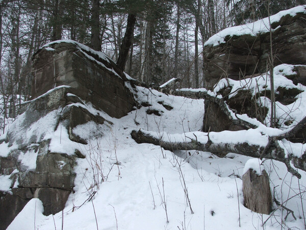
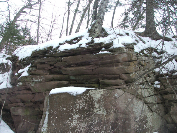
The best parks have unique features within them—Lincoln Park has Elephant Rock, Chester has a cell tower disguised as a tree, Park Point has the ruins of a lighthouse. Chambers Grove, too, has a unique feature: the main quarry itself.
Of all the abandoned quarries in Duluth, the Chambers Grove quarry is undoubtedly one of the oldest. Resembling a large bite of sandstone taken from the shore of the St. Louis River, the quarry has walls maybe twenty feet high or so, composed of brittle, cracking layers in some places and smooth faces of solid sandstone in others. The only way to approach the quarry is from above (or from the river). A notch cut into the wall of the quarry provides a ramp down to the floor. Up close, drilled holes are evident in the stone.
Chambers Grove isn’t a gigantic park, but the main quarry isn’t as obvious as you might think. It’s filled with trees and brush, and very overgrown in the summer. The new interpretive trail passes by some smaller excavations, but avoids bringing visitors to the main quarry. The casual observer could easily fail to realize it’s there.
But now that the interpretive trail has opened up the woods, the quarry can expect more visitors. When the trail turns away from the river to lead people back to their cars, some of your friends will continue following the river onward and find the quarry pretty quickly. When I went out there the other day, tracks in the snow showed that some people already had. Hopefully, it can handle a little traffic.
Mud Lake super-meeting
The question of what to do about the Mud Lake causeway continues to hang in limbo. People will remember that Mayor Emily Larson unveiled a plan to remove the causeway in 2017, saying that it would open the waters of Mud Lake to the St. Louis River at large and help restore the ecological health of the estuary. Natural resource professionals hailed the plan, but the volunteers who operated the present-day LSMR tourist train on the tracks across the causeway strongly objected. By removing the most popular feature of their ride, they felt, the city would doom their operation.
Following that meeting, I wrote a number of articles showing that the city had been conspiring with natural resource professionals to remove the causeway for months before the mayor made her announcement, all while saying publicly that they hadn’t reached a decision. My articles, among other factors, caused the city to take a step back and regroup. They did not, however, abandon their plan.
Despite the fact that the LSMR essentially created Duluth as a city, the administration has consistently opposed any formal designation of historical significance for the railroad—perhaps fearing that a historical designation would make the causeway more difficult to remove. In 2018, when the Heritage Preservation Commission (against the administration’s wishes) voted to seek historical designation for the LSMR line and sent the measure on to the City Council, the administration convinced the Council to send the measure back for “further consideration”—essentially stopping the historical designation in its tracks.
But the city has to make a decision sometime. The causeway issue is connected to the much larger US Steel cleanup plan nearby. Planning for the $70 million project has gone on for years, longer than anyone anticipated, and the current government shutdown has delayed things further, but sooner or later the Environmental Protection Agency and U.S. Steel will ask the city to make specific commitments in return for specific compensation, so that the project may begin. It’s unlikely that the city would be able to find money for causeway removal anywhere else.
On Jan. 8, 2019, City Planner Adam Fulton informed the Planning Commission that the city hoped to hold a “super-meeting” among the Planning Commission, the Parks Commission, and the Heritage Preservation Commission to discuss Mud Lake and “what’s our game plan for bringing that site back to productive use.” Fulton said the city was waiting for the EPA to release a report on Mud Lake. The city wanted to hold the super-meeting soon after.
It is unclear what the city hopes to accomplish with the super-meeting, but one thing is certain: They’ll need a big room. The three commissions have 27 members in total.
Hopefully, the EPA’s report will present hard data on Mud Lake’s ecology, rather than speculation, but even if it does, what then? Will the administration present a plan for Mud Lake and invite feedback? Is everybody supposed to come to a consensus?
Planning Commission President Michael Schraepfer had a more practical question about the meeting. “Who runs it?”
“Who runs it is a good question,” said Mr. Fulton. “I guess we’ll have to, you know, [play] Rock, Paper, Scissors between the three chairs of the commissions. I’m not sure.”
So the concept of super-meetings still has a few kinks to work out. Meanwhile, the causeway patiently awaits its fate, hoping Rock wins it all.
Author’s acknowledgement: Much of the information in this article came from the website zenithcity.com, a fine source for local history.
| Tweet |

