News & Articles
Browse all content by date.
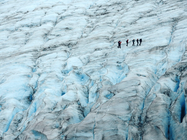
From the Marmot Meadows Overlook we watched other guided groups walk on the ice. They looked like tiny ants on such a giant landform. Photo by Emily Stone.
Helmet, crampons, harness, warm layers, trekking poles, camera. My pack was heavier than usual—and my excitement stronger—as we caught glimpses of white ice and blue crevasses beyond the canyon’s edge.
Two days after my first hike up the Harding Ice Field trail in Kenai Fjords National Park, I was at it again. The damp, gray, foggy weather was the same, but my mission was different. This time I was going to walk on the glacier. After watching adventure movies and adding a healthy dose of common sense, it’s not an adventure I’d felt comfortable doing solo. Nick, a guide from Adventure 60 North in Seward, led the way, and a retired doctor and his architect wife from Colombia (she runs the family’s banana plantation on the side) completed our little crew.
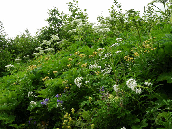
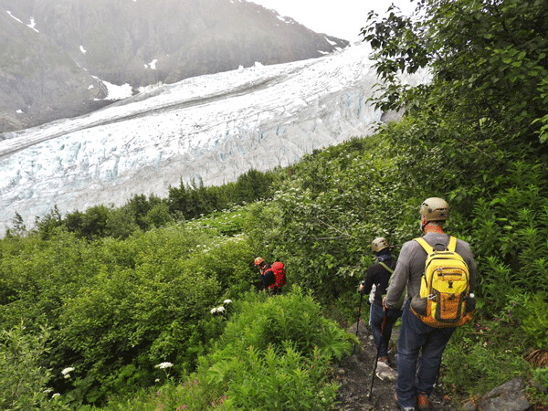
At the Marmot Meadows overlook we began to descend out of the lush field of wildflowers and straight down toward the white, blue, and brown wrinkles of the glacier along a rocky trail. The National Park Service doesn’t maintain this route, but several local guide services use the path.
The side of the glacially carved valley was steep here. At the height of the last ice age, 23,000 years ago, Exit Glacier filled the entire gorge. When our footing transitioned from ice-scoured bedrock to piles of loose gravel deposited by melting ice, Nick paused to point out that in past years he could walk straight out from this bench onto the ice. The dirty edge of the glacier now lay at least 20 feet below.
Moulins are roughly circular, well-like shafts in glacial ice. Water and sediment flow down into them. Photo by Emily Stone.
According to the Park Service, the terminus of Exit Glacier retreated 1,635 feet up its valley and thinned by almost 300 feet between the years of 1950 and 1990. The rate of thinning has only increased since then. In the past ten years it has retreated 1,000 more feet. Former President Barack Obama visited Exit Glacier in 2015, to highlight the effects of climate change. The toe of the glacier has become so unstable that visitors are no longer allowed anywhere near it. We’d hiked 1.5 miles up steep switchbacks and flights of stone stairs in order to gain access.
At a level spot in the dirt we paused again, this time to layer on winter clothes, tighten rescue harnesses around our waists, fasten climbing helmets under our chins, and strap saber-toothed crampons to our boots. Nick traded his trekking pole for an ice axe. His big backpack was full of rescue gear. “Keep your steps high and wide,” he repeated as we made our first tentative moves in the mean-looking crampons. “High, wide, high wide,” I reminded myself. And, finally, I was walking on a glacier.
The landscape was a gracefully sculpted expanse of luminous snow and ice, sprinkled liberally with brown dirt. Scalloped divots at a variety of scales were rimmed in a dark lace of dust that had been picked up, ground down, and then freed from melting ice. Rivulets of water cut narrow ravines through the dirty surface and created small, white-walled canyons with intensely blue bottoms. Those small ravines probably flowed along the tracks of healed crevasses.
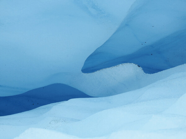
Crevasses are cracks in the glacier that open and close as the ice moves over uneven terrain. Photo by Emily Stone.
As the ice moves over uneven ground, crevasses open and close. Deep within the glacier, high pressure allows ice to move through plastic deformation—similar to molten lava. Crystals bend, deform, and slide past each other. Near the glacier’s surface, though, it is more brittle. As the mass maneuvers around corners and over obstructions, the surface must stretch wider. When the ice stretches past its stress limit, crevasses crack open. Later, they may squeeze shut, leaving only a linear scar.
Stepping high and wide, and being sure to kick our crampons into the slippery surface with each step, Nick led us to a narrow crevasse. His long legs straddled it easily, and one by one we came forward to have a look. Although it was narrow enough that none of us could have fallen in, it was still comforting to have Nick’s steady hand on my harness as I gazed into the deep blue depths.
Nick, our guide from Adventure 60 North, knew the glacier well and was able to show us unique features while staying away from the more risky areas. Photo by Emily Stone.
It was an abrupt transition from lush meadows down to fresh gravel and then onto the ice. Exit Glacier is shrinking, so the hike keeps getting longer. Photo by Emily Stone.
Crevasses can be a hundred feet wide, thousands of feet long, and hundreds of feet deep. Water-filled crevasses may reach all the way to the glacier’s bed. Perhaps this crevasse had stayed small because of the absence of water.
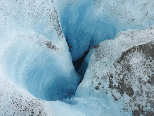
Nick also led us to the edge of a moulin. As before, he held onto our harness and we peered into it one-by-one. Water may have excavated this roughly circular, well-like shaft out of an old crevasse or found some other weakness in the ice. Either way, we watched a tiny stream glide over the surface and then cascade into the smooth, spiraling hole.
Sometimes the water will make its way down a moulin for a short distance and then find a horizontal route through the ice. Sometimes the water makes it all the way to the ground surface and flows under the glacier. Moulins play an important role in carrying water and sediment from the surface of the glacier into its depths. Mount Telemark, a 380-foot-tall old ski hill in Northern Wisconsin, was probably built by water-born sediment that poured into a large moulin 14,000 years ago at the end of the continental glaciation. I was thrilled to see a much smaller version of this glacial feature in action.
We all took a few more photos before making our way off this foreign land. While on the ice it felt like a fairytale winter. Luminous clouds hovered above, and luminous ice sat deceptively solid below. High and wide we stepped closer to the edge, the ratio of dirt to ice under our feet increasing steadily until we were back on the piles of sediment at the glacier’s lateral margin.
Our world is changing quickly. The thought that these glaciers are melting is a little terrifying. And yet, I’m intensely curious to witness the landscapes they will reveal. Several thousand years ago, the Chippewa and Superior Lobes of the Laurentide Ice Sheet melted away from the place I now call home. I ski on piles of sediment they left behind. I swim in lakes formed by melting ice blocks. Many times I’ve craned my neck back and gazed upward, trying to imagine the mile of ice that once loomed above my head. After exploring these living glaciers of Alaska, I feel like I better understand my own home.
Emily is in Alaska for the summer! Follow the journey in this column, and see additional stories and photos on her blog: http://cablemuseum.org/connect/.
For 50 years, the Cable Natural History Museum has served to connect you to the Northwoods. Come visit us in Cable, WI! Our new exhibit: “Bee Amazed!” is open.

| Tweet |